![](/images/other/stat-length.png)
![Randonnée A pied Eltville am Rhein - Gutenbergweg - Photo](https://media.geolcdn.com/t/1900/400/cd0c3ee6-7087-46a1-8c63-f960173d82e9.jpeg&format=pjpeg&maxdim=2)
Gutenbergweg
SityTrail - itinéraires balisés pédestres
Tous les sentiers balisés d’Europe GUIDE+
![Longueur](/images/other/stat-length.png)
![Altitude max](https://static1.geolcdn.com/siteimages/upload/files/1508320355ic_sort_altitude_max_24dp.png)
![Dénivelé positif](https://static1.geolcdn.com/siteimages/upload/files/1508320355ic_sort_den_pos_24dp.png)
![Km-Effort](/images/other/stat-length.png)
![Altitude min](https://static1.geolcdn.com/siteimages/upload/files/1508320355ic_sort_altitude_min_24dp.png)
![Dénivelé négatif](https://static1.geolcdn.com/siteimages/upload/files/1508320355ic_sort_den_neg_24dp.png)
![Boucle](https://static1.geolcdn.com/siteimages/upload/files/16400158638029165_repeat_loop_refresh_sync_direction_icon.png)
![A pied](https://static1.geolcdn.com/sitytour/trail-icons/100.png)
6h46
Difficulté : Moyen
![Scannez ce code QR pour ouvrir la randonnée dans l'application SityTrail](https://capi.geolives.com/qq0zvz2zws4bq2lad0pu/sitytour/trails/3101480/qr.png?size=200)
Application GPS de randonnée GRATUITE
À propos
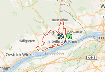
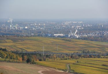
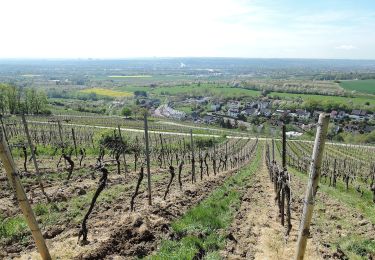
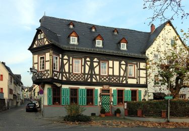
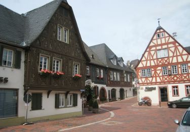
Randonnée A pied de 24 km à découvrir à Hesse, Rheingau-Taunus-Kreis, Eltville am Rhein. Cette randonnée est proposée par SityTrail - itinéraires balisés pédestres.
Description
Randonnée créée par Stadt Eltville.
Symbole: Grünes, aufgeschlagenes Buch mit großem, weißen G auf der linken Seite, schwarz unterschrieben mit "Gutenbergweg" auf weißem Grund
Localisation
Commentaires
Randonnées à proximité
![Randonnée A pied Ingelheim am Rhein - Kaiserpfalzweg - Photo](https://media.geolcdn.com/t/375/260/fce84757-c52f-41cd-87c3-4d4da52e38d6.jpeg&format=jpg&maxdim=2)
![A pied A pied](https://static1.geolcdn.com/sitytour/trail-icons/100.png)
A pied
![](/images/other/stat-length.png)
![](https://static1.geolcdn.com/siteimages/upload/files/16400158638029165_repeat_loop_refresh_sync_direction_icon.png)
![Randonnée A pied Eltville am Rhein - Rheinsteig-Zuweg Eltville - Photo](https://media.geolcdn.com/t/375/260/27ade83c-c43d-4b74-8817-38b2f29ada10.jpeg&format=jpg&maxdim=2)
![A pied A pied](https://static1.geolcdn.com/sitytour/trail-icons/100.png)
A pied
![](/images/other/stat-length.png)
![](https://static1.geolcdn.com/siteimages/upload/files/16400158638029165_repeat_loop_refresh_sync_direction_icon.png)
![Randonnée A pied Kiedrich - Kiedrich 7: - Photo](https://media.geolcdn.com/t/375/260/2c023441-fc39-40c2-b5a2-5f669c44ef98.jpeg&format=jpg&maxdim=2)
![A pied A pied](https://static1.geolcdn.com/sitytour/trail-icons/100.png)
A pied
![](/images/other/stat-length.png)
![](https://static1.geolcdn.com/siteimages/upload/files/16400158638029165_repeat_loop_refresh_sync_direction_icon.png)
![Randonnée A pied Eltville am Rhein - Rheinsteig-Zuweg Niederwalluf (West) - Photo](https://media.geolcdn.com/t/375/260/37c3ad44-bffd-4d35-9f40-789cd2c4f541.jpeg&format=jpg&maxdim=2)
![A pied A pied](https://static1.geolcdn.com/sitytour/trail-icons/100.png)
A pied
![](/images/other/stat-length.png)
![](https://static1.geolcdn.com/siteimages/upload/files/16400158638029165_repeat_loop_refresh_sync_direction_icon.png)
![Randonnée A pied Eltville am Rhein - Rheinsteig Rundtour: Rauenthaler Spange - Photo](https://media.geolcdn.com/t/375/260/f17f7bce-e902-429b-8a92-95a9e738d243.jpeg&format=jpg&maxdim=2)
![A pied A pied](https://static1.geolcdn.com/sitytour/trail-icons/100.png)
A pied
![](/images/other/stat-length.png)
![](https://static1.geolcdn.com/siteimages/upload/files/16400158638029165_repeat_loop_refresh_sync_direction_icon.png)
![Randonnée A pied Inconnu - Rheinsteig-Zuweg Dotzheim - Photo](https://media.geolcdn.com/t/375/260/31beef47-d5a6-4c5c-b727-2ab898f7bcef.jpeg&format=jpg&maxdim=2)
![A pied A pied](https://static1.geolcdn.com/sitytour/trail-icons/100.png)
A pied
![](/images/other/stat-length.png)
![](https://static1.geolcdn.com/siteimages/upload/files/16400158638029165_repeat_loop_refresh_sync_direction_icon.png)
![Randonnée A pied Eltville am Rhein - Wanderweg 2 Pfeile - Photo](https://media.geolcdn.com/t/375/260/7f050105-329f-4490-aedd-e05ef6c47d1b.jpeg&format=jpg&maxdim=2)
![A pied A pied](https://static1.geolcdn.com/sitytour/trail-icons/100.png)
A pied
![](/images/other/stat-length.png)
![](https://static1.geolcdn.com/siteimages/upload/files/16400158638029165_repeat_loop_refresh_sync_direction_icon.png)
![Randonnée A pied Eltville am Rhein - Parkplatz](https://media.geolcdn.com/t/375/260/a5fa8808-7bc4-471d-87b3-b17e6f02ba71.jpeg&format=jpg&maxdim=2)
![A pied A pied](https://static1.geolcdn.com/sitytour/trail-icons/100.png)
A pied
![](/images/other/stat-length.png)
![](https://static1.geolcdn.com/siteimages/upload/files/16400158638029165_repeat_loop_refresh_sync_direction_icon.png)
![Randonnée A pied Eltville am Rhein - Weinwanderweg Hattenheim - Photo](https://media.geolcdn.com/t/375/260/4b135f47-5057-4961-aff8-f6857bafb806.jpeg&format=jpg&maxdim=2)
![A pied A pied](https://static1.geolcdn.com/sitytour/trail-icons/100.png)
A pied
![](/images/other/stat-length.png)
![](https://static1.geolcdn.com/siteimages/upload/files/16400158638029165_repeat_loop_refresh_sync_direction_icon.png)